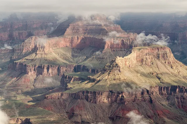
Grand Canyon is the mile-deep, 277-mile gash the Colorado River has sawed through northern Arizona, and the first view still lands like a physical event. This page concentrates on the South Rim, open all year and drawing about 90 percent of the park's visitors: the first-look shock of Mather Point, the stone watchtower at Desert View, the switchbacks of Bright Angel Trail, the sunset overlooks of Hermit Road, and raft trips on the river itself. The canyon suits every kind of traveler, from rim-and-shuttle sightseers to rim-to-river hikers to rafters who book a year or two ahead. Give it two full days, base yourself at Grand Canyon Village or Tusayan, enter before 10 a.m. in high season, and let the free shuttle buses do the driving.
Top sights at a glance
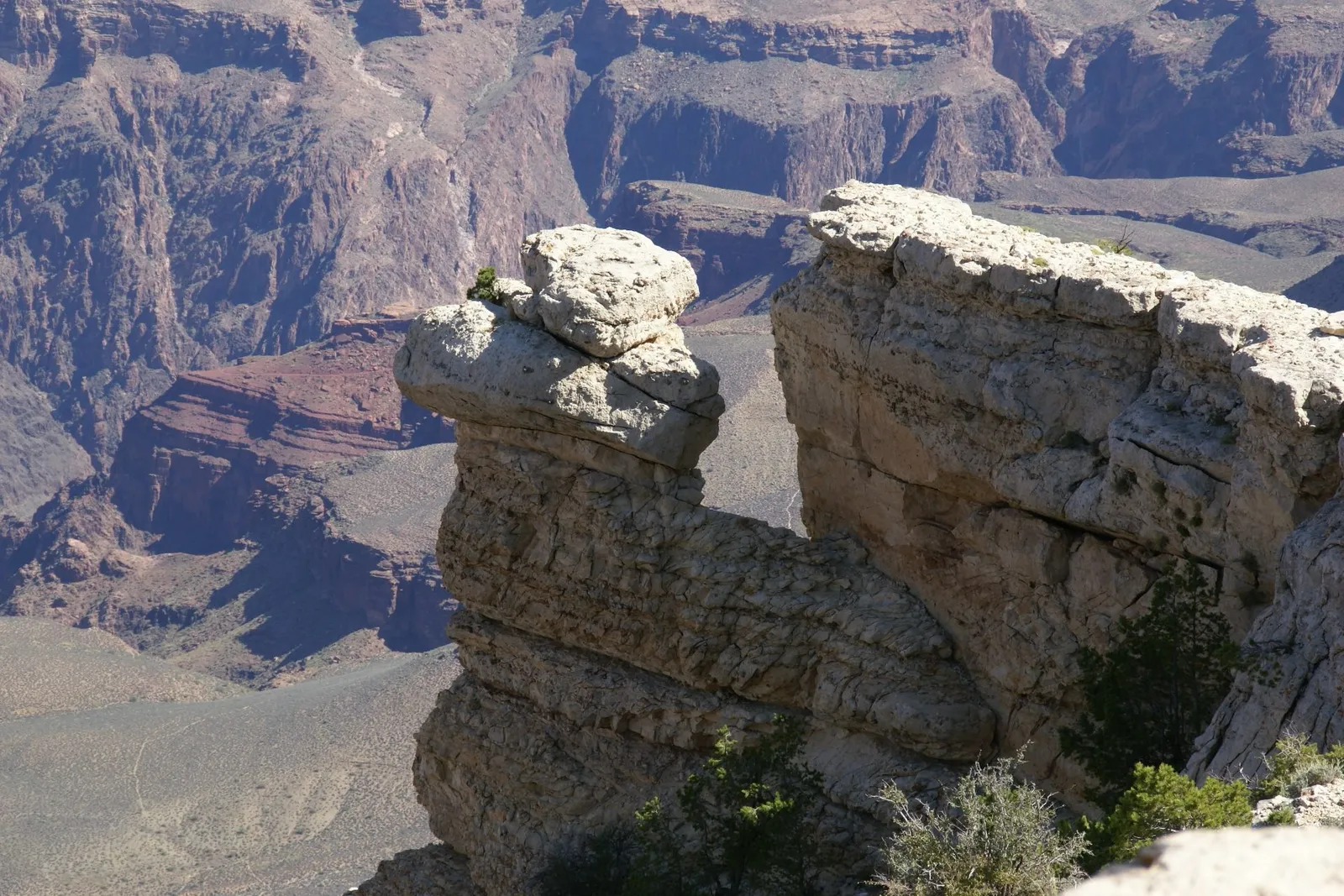
Mather Point
Mather Point is the canyon's front door: the first full view most visitors see coming from the South Entrance, a hoodoo-tipped promontory jutting over the abyss two minutes from the South Rim Visitor Center. It delivers the classic layered-wall panorama, from the rust Kaibab limestone on top to the dark Vishnu schist nearly a mile down, and it anchors the paved Canyon Rim Trail, so you can walk the rim instead of circling for parking.
Good to know · Park once at the Visitor Center plaza and walk; roadside spots at the point itself are scarce and gone by 9 a.m. in season. As of October 2026 the westbound Kaibab (Orange) shuttle stops here, so you can view it at the end of the day and ride home. Sunrise here is the quietest hour and the best light.
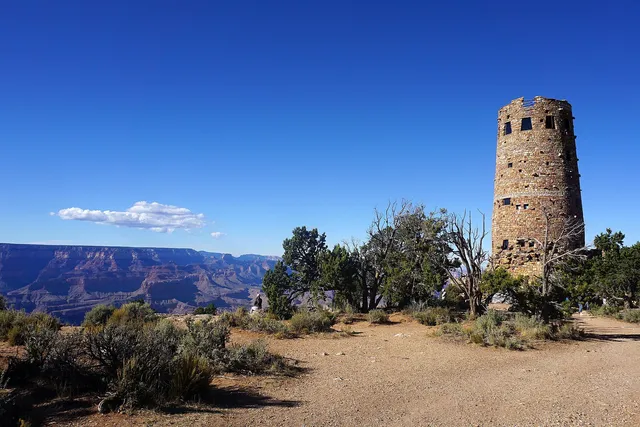
Desert View Watchtower
At the park's eastern end, where the Colorado turns north and the Painted Desert begins, Mary Colter's 1932 Watchtower rises above the rim, modeled on ancestral Puebloan towers and lined inside with murals by Hopi artist Fred Kabotie. Climbing its spiral stair earns the best river view on the South Rim, and the surrounding Desert View area doubles as an inter-tribal cultural site with demonstrations in the tower through the warm months.
Good to know · Desert View sits 23 miles east of Grand Canyon Village on Desert View Drive (State Route 64), about a 40-minute drive, and the East Entrance there is open 24 hours. As of October 2026 the tower is free but capacity-managed: a ticket system admits 25 people at a time for 20 minutes, with upper floors open roughly 8 a.m. to 6 p.m. when staffing allows. Combine it with the drive toward Cameron for Navajo frybread.
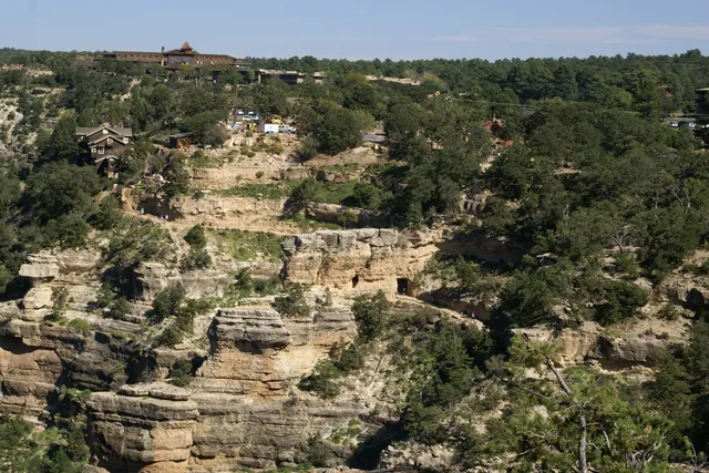
Bright Angel Trail
Bright Angel is the canyon's classic hike, dropping from the heart of the village through a fault-line shade gap past tunnels, resthouses, and the switchbacks that give the first mile its reputation. Day hikes of up to 12 miles round trip are possible, no permit required, and even a walk to the first tunnel changes your understanding of the canyon's scale. Mule trains share the trail, which is half the charm.
Good to know · Turn around at your half-water point, not your half-ambition point: the park warns against hiking rim to river and back in one day, especially May through September, and rescues more than 300 people from the canyon each year. Check water status at the Visitor Center or Backcountry Information Center, since seasonal water on the trail depends on a pipeline that breaks. In winter the upper trail can be icy; microspikes help.
Hermit Road
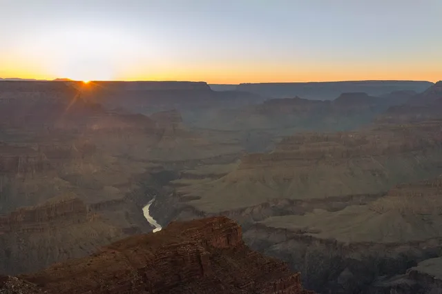
Hermit Road runs seven miles along the rim west of the village to Hermits Rest, strung with nine overlooks that include the canyon's best sunset perches at Hopi and Pima Points. From March 1 through November 30 it is closed to private cars and served by the free Red Route shuttle, which makes it the easiest structured evening in the park: ride out, walk a stretch of Rim Trail between viewpoints, ride back.
Good to know · The full shuttle round trip takes about 80 minutes without getting off, but plan two hours so you can hop between stops; return buses stop only at Hermits Rest, Pima, Mojave, and Powell Points. Sunset crowds pack Hopi Point, so arrive a full hour early or walk from one stop farther out. In December through February the road opens to private vehicles under 22 feet.
Colorado River Rafting
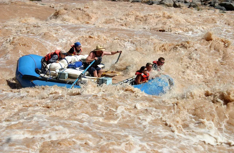
The Colorado River built the canyon, and running it is the park's deepest experience: 278 river miles of rapids, side canyons, and camps only boats can reach. Commercial motor and oar trips run from three to 18 days through the heart of the canyon, self-outfitted private trips run longer, and the river's calm water above the park, near Page, offers half- and full-day smooth-water floats for travelers without a week to spend.
Good to know · Book commercial trips directly with the licensed outfitters listed on the park's river concessioners page at nps.gov; full-canyon trips often sell out a year or two ahead, so reserve as soon as dates are real. Private trips are allocated by a weighted lottery, also via nps.gov. Day-trippers should compare the smooth-water trips from Page with the one-day whitewater run on Hualapai land at the canyon's western end, outside the park.
See it in motion
Some places earn a moving picture
Stills can't show how this place moves: the drift, the light show, the crowd flow. We picked a recent, high-quality walkthrough rather than a promotional cut.
A Beginner's Guide to Grand Canyon National Park and the South Rim
Sojourn Expedition · YouTube · plays on click
Embedded via YouTube's official player (privacy-enhanced mode). Video: A Beginner's Guide to Grand Canyon National Park and the South Rim by Sojourn Expedition. Not affiliated with Wide Open America; screened for quality and accuracy on 2026-10-15.
Every list of natural wonders includes the Grand Canyon, and the honest surprise is that the canyon survives the hype. The numbers are one thing: a mile deep, up to 18 miles wide, 277 miles of river inside the park, rock stacked through two billion years of Earth history. The experience is another: standing at the rim, the eye refuses the depth, the scale reads more like weather than rock, and every viewpoint rearranges it. This page concentrates on the South Rim, open all year, with the classic views and trailheads, equally a two-day sightseeing stop or the front door to serious hiking and rafting. Come early, ride the free shuttles, and give the canyon one sunset and one sunrise.
A Bit of History
People have lived in and around the canyon for at least ten thousand years, from the Paleo-Indian hunter-gatherers whose split-twig figurines survive in its caves to the ancestral Puebloan farmers whose granaries and dwellings still dot the inner gorge. Eleven tribes count the Grand Canyon as ancestral homeland today, including the Havasupai and Hualapai within the canyon itself, the Hopi and Zuni to the east and southeast, and the Navajo along its eastern border, and their presence is written into the park’s place names and its current cultural programs.
Europeans arrived late. Spanish scouts under Garcia Lopez de Cardenas reached the South Rim in 1540, stared at the same void, and gave up estimating its depth; for the next three centuries the canyon was a barrier, not a destination. The one-armed Civil War veteran John Wesley Powell ran the river through the canyon in 1869, and his expedition journal did what the Spanish reports never had: it made the canyon famous as the geological storybook of the continent.
Protection came in stages, against mining and railroad interests that wanted the rims. Theodore Roosevelt, who called the canyon the one great sight every American should see, declared it a game reserve in 1906 and a national monument in 1908; Congress made it a full national park on February 26, 1919. By then the Santa Fe Railroad’s spur line had reached the rim, in 1901, and the Fred Harvey company’s hotels and tours had invented the canyon’s first tourist economy. The 1920s and 1930s built the rim’s signature architecture, much of it by designer Mary Colter, whose Watchtower, Bright Angel Lodge, and Hermits Rest turned park buildings into interpretive acts. Mid-century dam proposals would have flooded the inner gorge, and their defeat in the 1960s fixed the river’s free-flowing status. UNESCO listed the park as a World Heritage Site in 1979. The canyon still makes history: the 2025 Dragon Bravo Fire closed the North Rim’s facilities and cut that rim’s 2025 season, and its recovery remains a live story, so check the park’s current status page before counting on the other rim.
Culture & Daily Life
The South Rim is a working park village, not a viewpoint with a gift shop, and it helps to think of it that way. Grand Canyon Village holds the visitor center, the historic railroad depot, lodges, a general store, a post office, campgrounds, and the park’s free shuttle network; the park draws well over five million visitors a year, about 90 percent of them to this rim, and the infrastructure exists to move that many people, if you use it. Park in the lots and ride: the Village (Blue), Kaibab (Orange), and Hermit Road (Red) routes, plus an early Hikers’ Express, cover everything a first visitor needs, and the culture of the place assumes you are on a bus.
The canyon is also tribal homeland in the present tense, and the park treats it that way. Desert View has been developed as an inter-tribal cultural heritage site, with Native demonstrations in the Watchtower in spring, summer, and fall, and the East Entrance road runs through the Navajo Nation toward Cameron, where trading posts and frybread stands are part of the trip rather than a detour. Rangers give geology talks at the rim, and California condors, reintroduced to the canyon in the 1990s, now sail over the village with ten-foot wingspans; give them, and every squirrel and elk, their distance, and never feed wildlife.
Two American constants frame the practical culture. Tipping runs 18 to 22 percent at table-service restaurants and $1 to 2 per drink at bars, with the full picture in /guides/tipping-and-sales-tax/. Posted prices exclude sales tax, which lands at the register, so budget with /tools/real-price-calculator/ before deciding what that rim-view dinner really costs. Cell data thins at the rim, so download the NPS App’s maps before you arrive. Alcohol is 21 and over with photo ID, enforced even at altitude.
Geology & Landscape
The canyon is a cross-section of the continent. The rock walls stack nearly two billion years of Earth history, from the black Vishnu schist at the river to the pale Kaibab limestone at the rim where you stand, and the gap between those layers, the carving itself, took the Colorado River and its ancestors roughly the last five to six million years, geologically a heartbeat. The result is 277 miles of river corridor up to a mile deep and 18 miles wide, the standard every other canyon is measured against.
Elevation writes the weather. The South Rim sits at about 7,000 feet, high enough for winter snow, while the inner canyon runs a zone hotter, dangerously so between May and September, which is why the park rescues more than 300 people a year and warns against hiking to the river and back in one summer day. Read the canyon from the rim first: Desert View Point at 7,360 feet gives the widest river views, and every overlook on Hermit Road rearranges the layers.
Treat the rim and the inner gorge as different environments: the Rim Trail is shaded and forgiving; below the rim, water, salt, and shade separate a great day from a rescue, and summer afternoons belong indoors. One practical note belongs here: US emergency care is not free for visitors, and an airlift out of the inner canyon without insurance can cost thousands of dollars, so confirm travel medical cover before your trip; see /guides/health-insurance-safety/.
Food & Drink
Eating at the South Rim is more functional than gastronomic, and the village layout makes it simple. The historic district holds the classic dining rooms, where dinner runs roughly $30 to 60 and the window seats frame the rim; cafeterias and food courts near the lodges cover families and odd hours for $12 to 22 a plate; and Market Plaza’s general store is a real grocery, which is why picnics are the local technique. Grab deli supplies and eat at an overlook instead of a table, especially at sunset, when the rim seats go faster than the restaurant ones. Picnic tables wait at nearly every shuttle stop.
Breakfast is the village’s quietest meal of the day: lodge coffee bars open early, the general store covers the basics, and the sunrise overlooks are empty enough to eat in. Anyone with strict dietary needs should stock up in Flagstaff or Williams before arriving, because village shelves carry staples rather than specialty ranges. Out east, Desert View keeps a market with a deli inside, closing at 5 p.m., so plan the eastern drive accordingly; in Tusayan, six miles south of the gate, chain restaurants handle the overflow, at small-town prices rather than park prices; and east of the park toward Cameron, Navajo vendors and the historic trading post serve frybread and Navajo tacos, a highlight worth planning a route around.
Alcohol is 21 and over with photo ID. Tipping is standard US practice, 18 to 22 percent for table service and $1 to 2 per drink at bars, detailed in /guides/tipping-and-sales-tax/, and menu prices gain Arizona sales tax at the register. Carry a refillable bottle: the park maintains drinking-water stations around the village and at key shuttle stops, and the desert air plus the altitude dehydrate people faster than they expect.
Top Sights
Mather Point
Mather Point is the canyon’s front door and still one of its best views. The promontory juts past the rim a short walk from the South Rim Visitor Center, and the panorama runs from the inner gorge nearly a mile below to the North Rim’s profile on the horizon. It was named for Stephen Mather, the first director of the National Park Service, and it is the standard first impression by design: the road from the South Entrance delivers you here within minutes of the gate.
The practical genius is behind it. Park at the Visitor Center plaza and walk out; as of October 2026 the westbound Kaibab (Orange) shuttle stops here, so you can watch sunset and ride home without touching the car. The paved Canyon Rim Trail runs from Mather toward the village and Yavapai Geology Museum. Come twice: sunrise for solitude, mid-morning to watch the light move down the walls. The railings are where the photos happen; the rocks past them are where the rescues happen.
Desert View Watchtower
Desert View is where the canyon stops being a wall and becomes a landscape: the river glints below and the Painted Desert opens east. Mary Colter’s Watchtower, built in 1932, rises 70 feet from the rim, its stone shell lined with murals by Hopi artist Fred Kabotie, and the top windows frame the best Colorado River view on the South Rim.
The tower is free but ticketed: as of October 2026 a ticket system admits 25 people at a time for 20-minute visits, upper floors open roughly 8 a.m. to 6 p.m. when staffing allows. Native artists give cultural demonstrations in the tower through the warm months. Desert View sits 23 miles east of the village, about 40 minutes along Desert View Drive, and doubles as the park’s East Entrance, open 24 hours; make it your exit toward Cameron and never backtrack.
Bright Angel Trail
Bright Angel is the trail every switchback photo was taken on: it starts just west of Bright Angel Lodge, follows a shady fault break past tunnels and resthouses, and crosses the Tonto Platform toward the river. No permit is needed for day hikes, distances run up to 12 miles round trip, and the shade and seasonal water make it the canyon’s most forgiving descent.
Forgiving is relative. The park’s guidance is blunt: there are no easy trails into or out of the Grand Canyon, do not hike rim to river and back in one day, especially May through September, and the park rescues more than 300 people a year, most overcommitted on exactly this trail. Set your turnaround by your water, not your ambition; even the walk to the first tunnel is complete. Check water status at the Visitor Center, since the trail’s seasonal water rides on a pipeline that breaks. Mule trains, booked as much as 15 months ahead, share the upper trail; in winter it ices over, and microspikes are the difference between a hike and a slide.
Hermit Road
Hermit Road is the rim at its most cinematic: seven miles west from the village to Hermits Rest, nine signed overlooks, and, from March 1 through November 30, a ban on private cars in favor of the free Red Route shuttle. The result is the best-structured evening in the park: ride out, pick your sunset point, and let a bus carry you home.
Trailview Overlook looks down on Bright Angel’s switchbacks, Hopi Point juts farthest toward the gorge as the classic sunset perch, and the road ends at Hermits Rest, Mary Colter’s stone tumble of a building. Return buses stop only at Hermits Rest, Pima, Mojave, and Powell Points. The full ride is about 80 minutes round trip, but give the evening two hours and walk one stretch between viewpoints. Sunset crowds stack up at Hopi Point an hour early, and in December through February the road reopens to private vehicles under 22 feet, with no shuttle.
Colorado River Rafting
Every rim visitor walks above the river that built the canyon; rafters meet it. The Colorado through the park runs 278 miles of rapids rated among the finest whitewater on Earth, and the park’s own breakdown is the honest menu: guided commercial trips run 3 to 18 days, self-outfitted private trips run 12 to 25 days and are allocated by a weighted lottery, and shorter private runs on the western end take 2 to 5 days from Diamond Creek.
Commercial full-canyon trips, motor or oar, are booked directly with the licensed river concessioners listed at nps.gov, and the good dates often sell out a year or two ahead, so book as soon as dates are real. Costs run to several thousand dollars per person for a full canyon. Day-trippers have two options: smooth-water floats near Page, above the park, and one-day whitewater on Hualapai land at the canyon’s western end, outside the park, a long day from Las Vegas. Neither replaces the multi-day journey, but both put you on the river.
Getting There & Around
The South Entrance sits six miles north of Tusayan, the gateway town with the nearest airport. Most drive in from Phoenix, about four hours, or Flagstaff, 90 minutes; Williams, an hour out on Interstate 40, sends the Grand Canyon Railway to the village depot daily. From Las Vegas it is about four and a half hours, the route covered in /itineraries/southwest-parks-road-trip/. The East Entrance at Desert View connects to Cameron on the Navajo Nation.
Entrance is simple: as of October 2026 there is no reservation, no timed entry, and no cash accepted, just the $35 pass, valid seven days. Non-US residents 16 and over pay an extra $100 per person unless they hold an annual pass; for most international trips the sensible move is the $250 Non-Resident Annual Pass, covering a full vehicle’s entrance and surcharges for 12 months, since the $80 America the Beautiful pass is sold only to US residents. The full arithmetic is in /guides/national-parks-guide/.
Inside the park, ride the shuttles: the free Village (Blue), Kaibab (Orange), and Hermit Road (Red) routes interconnect at the Visitor Center, the Hikers’ Express runs early buses to the South Kaibab trailhead, and trailhead parking is a dawn sport. Enter before 10 a.m. or after 2 p.m. on peak days, with the NPS App’s offline maps downloaded.
Where to Stay
Sleeping in the park is the experience, and it books accordingly. Grand Canyon Village and its edge hold the rim’s lodges, cabins, and motel blocks, reservable through the park concessioner at grandcanyonlodges.com, where summer dates open as much as a year ahead and rim-view rooms go first; there is no lodging at Desert View. Campers can choose Mather Campground in the village and the small Trailer Village RV park, plus Desert View Campground near the east end, $18 a night and reservable up to six months ahead on recreation.gov, running roughly April through mid-October.
Tusayan, just outside the gate, is the overflow town: chain motels and the airport, with prices that rise to meet scarcity. Williams and Flagstaff are the budget bases, an hour to 90 minutes out, best for travelers pairing the canyon with Sedona or Route 66 rather than dawn photography.
Whatever the booking, price it honestly: park-region lodging adds Arizona sales tax and, at some Tusayan properties, resort-style fees, and the concessioner’s cancellation windows are strict. The bottom-of-the-canyon Phantom Ranch lodge is allocated through the mule-trip and hike-in lotteries rather than open booking, so treat it as a lottery ticket, not a plan.
Sources & verification (13)
- https://www.nps.gov/grca/planyourvisit/fees.htm
- https://www.nps.gov/aboutus/nonresident-fees.htm
- https://www.nps.gov/grca/planyourvisit/index.htm
- https://www.nps.gov/grca/planyourvisit/directions.htm
- https://www.nps.gov/grca/planyourvisit/shuttle-buses.htm
- https://www.nps.gov/grca/planyourvisit/hermit-road.htm
- https://www.nps.gov/grca/planyourvisit/day-hiking.htm
- https://www.nps.gov/grca/planyourvisit/desert-view.htm
- https://www.nps.gov/grca/planyourvisit/mule_trips.htm
- https://www.nps.gov/grca/planyourvisit/whitewater-rafting.htm
- https://www.nps.gov/grca/planyourvisit/one-day-river-trip.htm
- https://www.recreation.gov/camping/campgrounds/258825
- https://en.wikipedia.org/wiki/Grand_Canyon