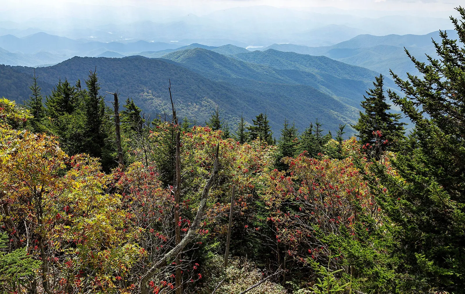
The Great Smoky Mountains are the green, fog-washed crest of the Appalachians on the Tennessee-North Carolina line, and the park wrapped around them is the most visited in the country, drawing well over twelve million people a year. The core experiences cost almost nothing: no entrance fee has ever been charged here, only a parking tag since 2023, and the signature sights are a sunrise from Kuwohi's observation tower, the 11-mile Cades Cove loop past churches and cabins, and the Appalachian Trail crossing at Newfound Gap. October is the crush season for fall color, June opens with a lottery-only firefly spectacle, and the gateway towns run from honky-tonk Gatlinburg to the quieter Cherokee and Townsend sides. Bring layers for weather that changes by elevation, and give the park two days minimum; three lets you hike Alum Cave and still see the loop roads.
Top sights at a glance
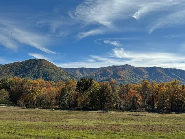
Cades Cove
An 11-mile one-way loop road circling a pastoral valley that is the park's single most famous drive: restored log churches, a working gristmill, barns and homesteads from the 1800s, all framed by mountains, with white-tailed deer in the fields most mornings and black bears working the tree lines. The park says it holds the widest variety of historic buildings of any area in the Smokies, and the self-guiding booklet at the loop entrance explains each stop. Cherokee hunters used the cove long before European settlers arrived around 1818 to 1821.
Good to know · Open sunrise to sunset; budget two to four hours plus hiking time. The road closes to vehicles on Wednesdays, typically May through September, which turns it into a walker's and cyclist's morning; on other days arrive by 9 a.m. or expect parking-lot pacing behind the tour line. The parking tag requirement applies; buy the $5 daily tag at the entrance area machine or in advance on recreation.gov.
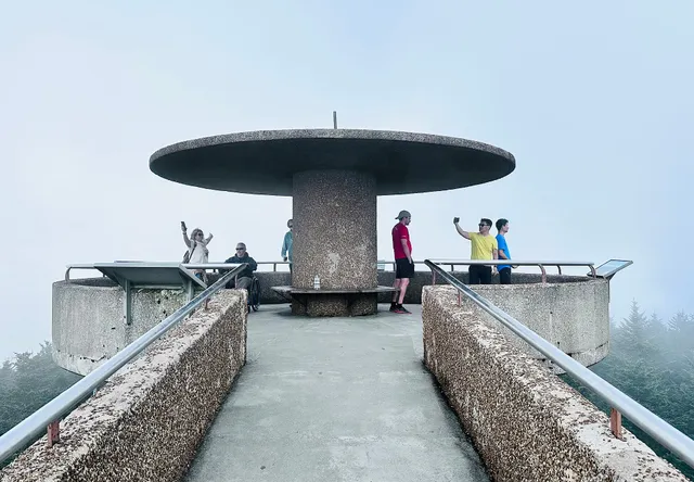
Kuwohi
The park's highest summit at 6,643 feet, called Clingmans Dome until September 18, 2024, when the U.S. Board on Geographic Names restored the Cherokee name Kuwohi, meaning mulberry place, at the request of the Eastern Band of Cherokee Indians. A steep half-mile paved trail climbs from the road's end to the concrete observation tower, a spiral ramp in the sky with 360-degree views that on clear days reach seven states; more often you will stand in or above the clouds that give the park its name. It is the tallest point in Tennessee and the third-highest summit east of the Mississippi.
Good to know · The road (renamed Kuwohi Road) and the small visitor center operate in the warm season; check current status at nps.gov/grsm before driving up, since the summit area closes in winter and weather shuts it intermittently. The climb is short but genuinely steep at altitude; take a layer, because the summit runs 10-15 degrees Fahrenheit cooler than Gatlinburg and wind makes it colder. Sunset from the tower is the classic payoff; go on a weekday and stay for the light show down the ridges.
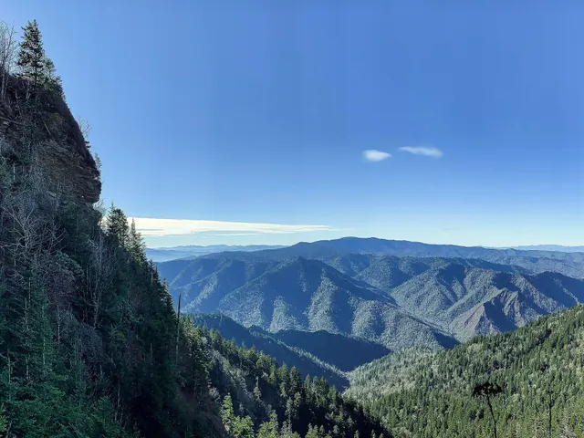
Alum Cave Trail
The park's signature day hike, starting on Newfound Gap Road and climbing alongside Alum Cave Creek through Arch Rock, a tunnel of stone steps cut beneath a boulder, up to Inspiration Point and the huge concave bluff of Alum Cave itself, a dark overhang with a violent Civil War-era saltpeter history, about 4.5 miles round trip. Above the bluff the trail keeps climbing through spruce forest toward Mount LeConte, whose lodge-based summit makes a serious 11-mile round-trip extension for strong hikers.
Good to know · Trailhead parking fills by mid-morning in every season; arrive before 8 a.m. from spring through fall or use the oversized lot with a short road walk. The trail is rocky and stays wet in stretches; real shoes, not sandals. The parking tag applies here like everywhere in the park, and afternoon thunderstorms are a summer constant, so start early and turn around if the sky builds.
Newfound Gap
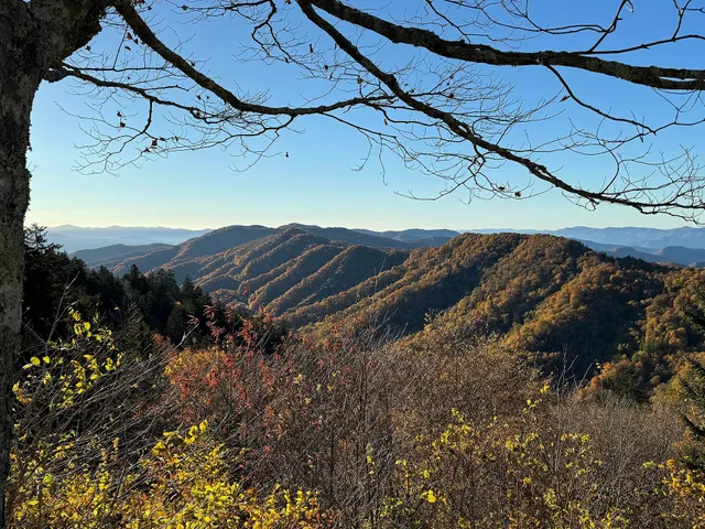
The 5,046-foot pass where Newfound Gap Road (US 441) crosses the spine of the Smokies between Gatlinburg, Tennessee and Cherokee, North Carolina, and the easiest place in the park to stand on the Appalachian Trail, which crosses the road right at the gap. The Rockefeller Memorial at the overlook marks the spot where President Franklin Roosevelt dedicated the park in 1940, and the view south drops into North Carolina's layered ridges. The gap is also the trailhead for the Kuwohi road walk in winter and a natural first-stop orientation between the park's two halves.
Good to know · Free to stop, parking tag required, and the lot is plowed year-round; US 441 over the gap occasionally closes for snow and ice in winter, so check the road status at nps.gov/grsm before crossing. The temperature difference between Gatlinburg and the gap is regularly 10-15 degrees Fahrenheit; this is where you learn why locals dress in layers. From here it is a short drive to Kuwohi Road's turnoff or down to the Oconaluftee Visitor Center and Mountain Farm Museum.
Roaring Fork Motor Nature Trail
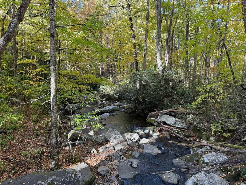
A narrow 5.5-mile one-way loop behind Gatlinburg that trades Cades Cove's crowds for a tighter, wilder ride: the stream the trail is named for, three log homesteads including the preserved Baxter cabin, the plug mill and cantilever barn, and the parking-side trailhead for Grotto Falls, the walk-behind waterfall. The road itself is the attraction, hugging the creek under a canopy that goes gold in late October, with pullouts every few hundred yards.
Good to know · Closed to vehicles in winter, typically November into May, and prohibited to buses, RVs, and trailers the whole season because of the tight turns; check the seasonal opening at nps.gov/grsm. Enter from Gatlinburg's eighth parkway traffic light and buy the parking tag before you settle in at a pullout. Grotto Falls adds 2.6 easy miles round trip from the trailhead inside the loop, and the whole motor trail takes about an hour of slow driving plus whatever walks you add.
The Smokies are what most of the world pictures when it pictures old American mountains: a blue-green wall of ridges stacked one behind another until the haze swallows them, running along the Tennessee-North Carolina border within a day’s drive of two-thirds of the eastern United States. That accessibility is the whole story. This is the most-visited national park in the country, north of twelve million people a year, and it has never charged an entrance fee, a condition written into the land’s original transfer that keeps the gate open to everyone. The 2023 addition of a parking tag ($5 a day) is the only mandatory cost, and it buys you 800 square miles of Appalachian high country: flame azaleas on Gregory Bald, synchronous fireflies in Elkmont, and enough black bears that the rangers’ first question about any plan is what you did with your food.
A Bit of History
The Cherokee knew these mountains as Shaconage, place of blue smoke, and their descendants, the Eastern Band, still live just outside the southern boundary at Cherokee, the town that carries their name; Kuwohi, the park’s highest peak, got its original Cherokee name restored in September 2024. European settlers moved into the coves and hollows in the early 1800s, and by 1900 the valleys were farmed, logged-over, and wired with railroads feeding the timber barons. The park idea arrived in the 1920s as a civic crusade: Tennessee and North Carolina bought and assembled hundreds of small farms, schoolchildren donated pennies, John D. Rockefeller Jr. added five million dollars, and in 1934 Great Smoky Mountains National Park was dedicated, with FDR speaking from Newfound Gap in 1940.
Two legacies of that founding shape your visit. The families who sold their land left behind their churches, mills, and cabins, more than 90 of which still stand, the largest collection of historic log buildings in the East. And the New Deal crews who built the roads designed them as scenic experiences, which is why Newfound Gap Road and the Cades Cove loop still read like drives through a landscape on purpose.
Geology & Landscape
The Smokies are among the oldest mountains on Earth, thrust up roughly 200-300 million years ago and worn down ever since; the rocks are Precambrian sandstone and slate over a billion years old in places, and the ridgelines run northeast-southwest in long parallel waves. The fog that names the park is not smoke but breathing forest: the spruce-fir caps and dense hardwoods exhale moisture and terpenes that layer blue against the ridges, thickest at dawn and after rain. Elevation runs from about 875 feet to 6,643 at Kuwohi, and the vertical span packs in what amounts to a walk from Georgia to Maine in plant zones: cove hardwoods with tulip poplars ten feet around, northern hardwoods, and a Canadian-style spruce-fir forest on top found this far south nowhere else.
Wildlife is the park’s second headline after the views. This is one of the densest black bear populations in America, and sightings are routine from Cades Cove to the roadside pullouts; stay at least 50 yards away (the park says more for bears, and it means it), never feed anything, and lock food in the car trunk. White-tailed deer, turkeys, and elk (reintroduced in 2001 and best seen near Oconaluftee and Cataloochee) round out the marquee. The elk fields at dusk are a reliable family evening. For hikers, illness and injury are the real backcountry risks; sort insurance before the trip at /guides/health-insurance-safety/.
Culture & Daily Life
The Smokies’ culture is split-screen. On the Tennessee side, Gatlinburg and Pigeon Forge run full-throttle Americana: pancake houses, moonshine distilleries, Ripley’s Believe It or Not, and Dollywood ten minutes up the road, a funnel-cake economy that repels some travelers and delights others. The North Carolina side is quieter and partly Cherokee: the town of Cherokee is the Eastern Band’s capital, with the Museum of the Cherokee Indian and the outdoor drama Unto These Hills, and the park’s southern entrance runs through it. Townsend, the third gateway, is the locals’ pick for a calm base on the quiet side of Cades Cove.
Daily rhythms: October weekends are the busiest of the year, a leaf-peeping migration that fills every motel within 50 miles; book fall trips months out. Summer afternoons build thunderstorms, and the high country holds clouds when the valleys are clear, so check the Newfound Gap weather, not Gatlinburg’s. Restaurants are casual and tipping runs 18-22 percent, arithmetic at /guides/tipping-and-sales-tax/; Tennessee and North Carolina sales taxes both land around 7-9.5 percent combined depending on county.
Food & Drink
The gateway food scene is Southern mountain cooking: pancakes in absurd variety (Gatlinburg’s signature dish, unironically), biscuits and gravy, country ham, fried chicken, trout, and pinto beans with cornbread, with moonshine tasting rooms and cideries on the Tennessee side and fry bread stands near Cherokee. Inside the park there is no lodging or restaurant at all beyond camp stores and vending, so eat in town; the picnic areas, including Cades Cove’s and Chimneys’ riverside tables, are the best lunch rooms in the park. Budget US$12-20 for breakfast, US$15-30 casual dinner, more on the parkway in Gatlinburg. Two practical notes: Sunday brunch lines in October are serious, and the park’s bears treat coolers as an invitation, so never leave food in a car’s open bed or a picnic table unattended.
Top Sights
Cades Cove
The valley every brochure photographs, and the park’s one unmissable drive. The 11-mile one-way loop circles a cove of open fields and woodlots with the historic district strung along it: the Primitive Baptist, Methodist, and Missionary Baptist churches, the Cable Mill with its working wheel and blacksmith shop, the Tipton and Gregg-Cable houses, and barns in styles you can compare from the road. Wildlife delivers most mornings: deer herds in the meadows, turkeys, bears at the woods’ edge, coyotes at dawn. Budget two to four hours at touring pace, longer with walks, and use the paved pullouts rather than stopping in the lane (the rangers are strict and right).
Two timing rules make or break it. First, arrive at or before the 9 a.m. gate rush in peak season, or come after 3 p.m. when the line thins; midday October weekends can turn the loop into a slow parade. Second, Wednesdays, typically May through September, the loop is vehicle-free until evening, the single best structured experience in the park for cyclists and walkers: rent bikes in Townsend or walk the first miles of the loop with the valley to yourself. The parking tag ($5 daily, machines at the loop entrance and visitor centers, or print-at-home on recreation.gov) applies here like everywhere.
Kuwohi
The top of Tennessee and the park’s big view, 6,643 feet, renamed from Clingmans Dome in September 2024 after the Eastern Band of Cherokee Indians petitioned to restore Kuwohi, mulberry place, the mountain’s Cherokee name. From the end of Kuwohi Road (formerly Clingmans Dome Road, closed in winter), a steep half-mile of paved path climbs to the observation tower, a spiraling concrete ramp whose deck sits above the spruce-fir canopy; on clear days the claim is you can see seven states, and on the far more common cloudy days you get the truer Smokies experience of standing over a sea of fog with ridge tops poking through.
Bring the layer you think you won’t need: the summit regularly runs 10-15 degrees Fahrenheit colder than Gatlinburg with a wind that makes it colder still, even in July. The visitor center at the trailhead is small; the bathroom line is long at midday. Sunrise and sunset are the photographer’s hours (the road gate opens and closes around them in season, check nps.gov/grsm for times), and the Forney Ridge Trail continues past the tower crowds into quiet spruce woods within ten minutes’ walk if the deck feels like a stadium.
Alum Cave Trail
The classic Smokies hike, and the best short-to-long day in the park because it keeps revealing. From the trailhead on Newfound Gap Road the path follows Alum Cave Creek uphill on stone steps, squeezes through Arch Rock, a stair-pass beneath a boulder perched on other boulders, passes Inspiration Point’s view down the valley, and reaches Alum Cave Bluffs at 2.2 miles up: a towering concave overhang, not a cave at all, where a Civil War-era operation mined saltpeter for gunpowder and Epsom salts. The bluff is the standard turnaround, 4.4 miles round trip with about 1,100 feet of gain.
Strong hikers continue: above the bluff the trail steepens through spruce forest to the top of Mount LeConte at 6,593 feet, where a lodge village (reservable roughly a year ahead through the lodge’s own site) and Cliff Tops’ view make an 11-mile round trip day. Whatever distance you choose, start before 8 a.m. for parking and weather; the lot is one of the first in the park to fill, the trail stays damp, and summer afternoon thunderstorms turn the upper reaches exposed. Parking tag required.
Newfound Gap
The pass through the middle of everything. At 5,046 feet on US 441, Newfound Gap is where the Appalachian Trail crosses the road, a white-blazed line you can follow north toward Charlies Bunion or south toward the gap’s quiet spruce woods; the Rockefeller Memorial platform, where FDR dedicated the park in September 1940, looks south into North Carolina’s layered ridges. On a clear October morning it is the best free view in Tennessee.
It is also the practical hinge of a Smokies visit: an hour’s drive from Gatlinburg to Cherokee with the road’s own succession of overlooks, and the turnoff for Kuwohi Road sits a mile west. Winter travelers take note, US 441 over the gap closes intermittently for snow and ice from November through spring, and the park posts status at nps.gov/grsm; when it closes, the detour around the park is over an hour. Dress for the gap, not the valley, and use the restrooms here, because the next reliable ones are a mountain away.
Roaring Fork Motor Nature Trail
Gatlinburg’s back door into the quiet Smokies, a 5.5-mile one-way narrow loop that begins just uphill of downtown and immediately trades the parkway noise for a creek-hugging road under full canopy. The stops are intimate rather than epic: the Noah “Bud” Ogle homestead’s tub mill, the place-name stream itself, the Alfred Reagan place with its cantilever barn, and the Ely’s Mill gateway at the top. Grotto Falls, 1.3 miles up its trailhead from the loop, is the waterfall you walk behind, the only one in the park where that’s legal and dry.
Rules to know: the motor trail is seasonal, closed to vehicles in winter (typically November into May), and always off-limits to RVs, trailers, and buses for its tight turns and low overhangs; verify the opening date each spring at nps.gov/grsm. Go in the first two hours after the gate opens, when the stream is loud, the light is in the trees, and the traffic is a car every few minutes instead of a caravan. In late October the loop’s maples make it the best near-town color drive in the park.
Getting There & Around
The park sits between two airport worlds: Knoxville’s McGhee Tyson (TYS), 45 minutes from Gatlinburg, is the main gateway, with Asheville (AVL) 1.5 hours from Cherokee on the south side for a two-airport trip. There is no public transportation into the park at all; a car is required, and Newfound Gap Road (US 441) is the single artery across, with Cades Cove, Roaring Fork, and Kuwohi roads as seasonal spurs off it. In summer and October the park runs limited shuttle service from Gatlinburg to popular trailheads (check current routes at nps.gov/grsm), but plan around your own wheels.
Drive times that surprise people: Gatlinburg to Cherokee over the gap takes a full hour of mountain road; Gatlinburg to Cades Cove is 45 minutes of winding approach before the loop even starts. Fuel up in town, because there is no gas in the park, and download offline maps, because cell service dies in the hollows.
Where to Stay
Gatlinburg is the loud center of gravity: walkable to restaurants and the park entrance, priced accordingly in October, book 3-6 months out for fall. Pigeon Forge, ten minutes north, is the family-value play, bigger lots, bigger breakfasts, and Dollywood, at the cost of the drive into the park. Townsend is the quiet side: small motels and cabins, a third of the traffic, and the natural base for Cades Cove mornings. On the North Carolina side, Cherokee offers casinos-resort pricing plus independent motels and the cultural sites, and Bryson City, twenty minutes on, is a genuine small town with a brewery and the Great Smoky Mountains Railroad. In-park, LeConte Lodge (summit, reservable far ahead) and ten campgrounds on recreation.gov are the only beds; whatever you choose, October weekends and the firefly weeks sell out first, and parking-tag money is separate from any lodging, so run the real total through /tools/real-price-calculator/.
Sources & verification (5)
- https://www.nps.gov/grsm/planyourvisit/fees.htm
- https://www.nps.gov/grsm/planyourvisit/cadescove.htm
- https://www.nps.gov/grsm/planyourvisit/kuwohi-nfg.htm
- https://www.nps.gov/grsm/learn/news/kuwohi-name-restored-to-the-highest-peak-in-the-smokies.htm
- https://www.nps.gov/grsm/learn/nature/fireflies.htm