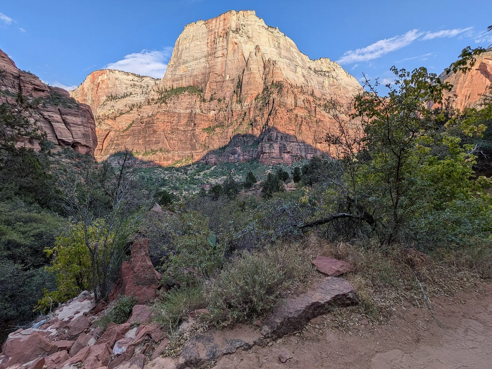
Zion is a 2,000-foot sandstone canyon in southwest Utah where the Virgin River did the sculpting and the crowds did the rest, roughly four and a half hours from Salt Lake City and under three from Las Vegas. The core experiences are riding the mandatory shuttle up the canyon floor, wading the Virgin River through the Narrows, and, for the sure-footed with a lottery permit, the chained final ridge of Angels Landing. Outside the July-August heat the park is at its best in April-May and September-October. Practical planning is everything here: the canyon closes to private cars most of the year, the flagship hike runs on a lottery, and 2026 rules add a per-person surcharge for non-US visitors aged 16 and over. Zion suits reasonably fit first-timers who book ahead and take the heat seriously; the lodge-and-shuttle version suits everyone else, and the Kolob Canyons section an hour north rewards anyone seeking quiet.
Top sights at a glance
Zion Canyon Scenic Drive
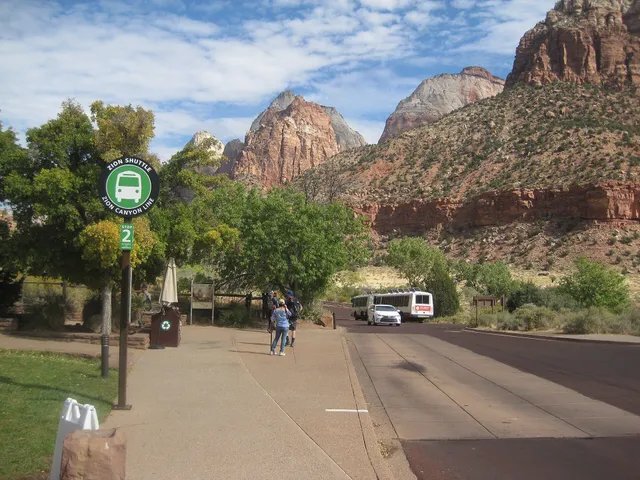
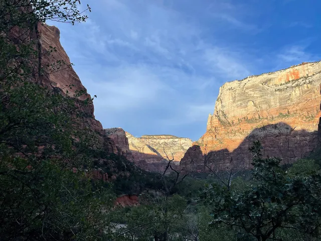
The six-mile dead-end road up the canyon floor past the park's greatest hits: Court of the Patriarchs, Zion Lodge, the Grotto, Weeping Rock, and the Temple of Sinawava at road's end, where the paved Riverside Walk delivers wheelchairs and strollers a mile along the river under hanging gardens. From roughly March through November private cars are banned and the free shuttle runs every 5-10 minutes, which turns the drive itself into the sight: 2,000-foot walls of Navajo sandstone stacked over cottonwoods and the milky-green Virgin River.
Good to know · The shuttle is free with entry and runs roughly March through November plus the late-December holidays; in the December-February off-season you can usually drive the road yourself. Check the current-season schedule at nps.gov/zion before planning a dawn start, because you cannot drive the road during shuttle season even before the first bus. Riding the full line and walking the Riverside Walk at the end makes an easy half day.
Angels Landing
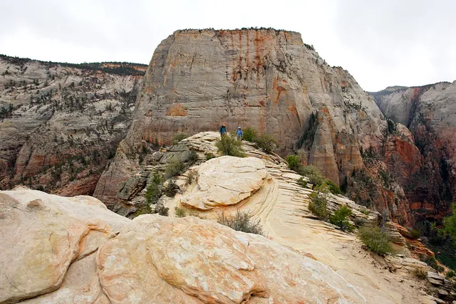
The most famous half mile of chained trail in America: from Scout Lookout, the path narrows onto a sandstone ridge with 1,000-foot drops on both sides, scrambling the last section with chains bolted into the rock to a summit view of the whole canyon. The West Rim Trail to Scout Lookout is a stiff but unprotected climb anyone can do; the chained section beyond is where the permit rules, and honestly your own judgment about vertigo and footwear, apply. Allow four to five hours round trip from the Grotto trailhead.
Good to know · A permit is required for the chained section year-round. Enter the seasonal lottery or the day-before lottery (open 12:01 a.m. to 3 p.m. Mountain Time, results emailed by 4 p.m.) at recreation.gov: a $6 non-refundable application fee, then $3 per person if issued, up to six people per application. Hike before 10 a.m. in warm months, carry more water than feels sensible, and screenshot the permit before you arrive because cell service in the canyon is poor.
The Narrows
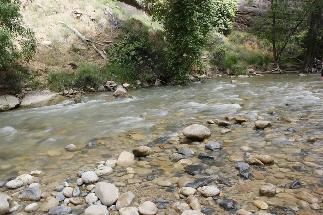
The Virgin River itself is the trail: from the end of the Riverside Walk you wade upstream into a slot canyon that narrows to 20 feet between walls 1,000 feet high, the deepest such gorge accessible without ropes in the national park system. Most walkers go an hour or two up and turn around; the bottom-up route runs about ten round-trip miles to Big Spring if you go all the way. Water is knee-to-waist deep in normal flow, cold even in August, and the scenery dwarfs anything dry in the park.
Good to know · Bottom-up from the Temple of Sinawava requires no permit; the 16-mile top-down through-hike from Chamberlain's Ranch requires a wilderness permit (nps.gov/zion). Rent canyon shoes, neoprene socks, and a pole in Springdale rather than wrecking sneakers, and check the flow and forecast at a visitor center: the canyon closes when the river runs above 150 cfs or under a Flash Flood Warning, and it reopens no sooner than two hours after a warning lifts. Never enter with storms anywhere in the forecast; flash floods here are the park's deadliest hazard.
Emerald Pools
A three-tiered chain of pools and dripping seep-hanging gardens reached from the Zion Lodge area: the Lower Pool on a paved, family-friendly third of a mile, the Middle Pool above it, and the Upper Pool at the base of a 300-foot amphitheater of stone, about a mile and a half each way with modest climbing. The trails thread behind weeping walls where water percolates out of the sandstone and everything turns improbably green, the single best shade hike in the park and the standard answer to 'what do we do this afternoon'.
Good to know · Free, no permit, trailhead across from the Zion Lodge shuttle stop. Combine with the lodge for lunch and you have the park's easiest half day; start before noon in summer because the middle and upper sections lose their shade by early afternoon. Trails here periodically close after rockfall or ice, so glance at the current conditions list at nps.gov/zion the morning you go.
Kolob Canyons
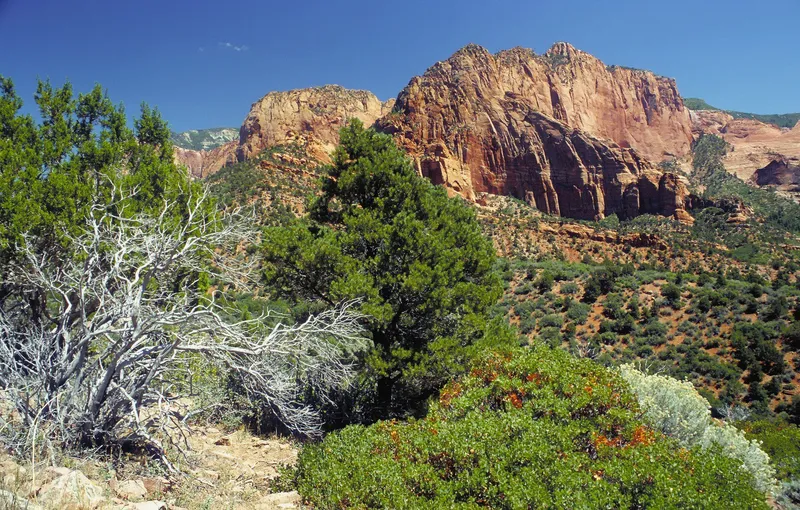
Zion's forgotten half: a separate park section at Exit 40 on Interstate 15, 40 miles north of the main canyon, where a five-mile scenic road dead-ends at a natural amphitheater of 1,500-foot crimson finger canyons. Most visitors never make it here, which is the point; the Timber Creek Overlook Trail at road's end is an easy mile with a huge payoff, and the area is managed as designated wilderness with over 20 miles of quiet trails. The finger canyons glow at sunset in a way the main canyon cannot match.
Good to know · Your Zion entrance pass or interagency pass covers it; everyone must stop at the Kolob Canyons Visitor Center to show a pass or pay. It is about an hour's drive from Springdale, so pair it with arrival or departure day if you are coming or going on I-15 toward Las Vegas or Cedar City. The road closes temporarily for snow and ice in winter; check the park's current conditions before the drive.
Zion is the park that teaches you to read a landscape vertically. The main canyon is a crack in the Colorado Plateau where the Virgin River has cut 2,000 feet down through salmon-pink Navajo sandstone, and nearly everything visitors love about it happens on the canyon floor: a shuttle instead of cars, a river you walk up instead of a trail, and a ridge you climb with chains bolted into the rock. It is also, by most counts, among the five busiest national parks in the country, with visitation in the four-to-five-million range a year, which is why the logistics here matter more than anywhere else in Utah. Go in spring or fall, take the heat rules seriously, book the gateway town early, and the park will feel generous rather than besieged.
A Bit of History
Mormon pioneers arrived in the canyon in the early 1860s, naming it Zion, a place of refuge, and farming the floor where the lodge now stands; you can still see their handiwork in the irrigation ditches and the ghost town of Grafton a few miles downstream. The federal government caught up in 1909, protecting the area as Mukuntuweap National Monument, a name from the Southern Paiute language that locals promptly ignored; it became Zion National Park in 1919, one of the original anchors of the system’s expansion.
The engineering feat that opened the park to the automobile age is the 1.1-mile Zion-Mount Carmel Tunnel, finished in 1930 on the road to Bryce Canyon and the Grand Canyon’s North Rim, its galleries cut so motorists could pause and look out over the canyon country. In 2000, with traffic choking the dead-end scenic drive, the park made the decision that defines a visit today: shuttle-only access to the canyon floor most of the year. In 2022 the park capped the final pitch of Angels Landing behind a lottery, ending the era of queue-jostling on a cliff edge.
Geology & Landscape
Zion’s rock story is a stack of dunes. Around 200 million years ago the largest sand desert North America has ever known covered this region, and its lithified dunes became the Navajo Sandstone that forms the canyon’s upper 2,000 feet; the streaking black and white on the walls is desert varnish, iron and manganese oxides bled down the faces. The Virgin River, small as it looks, moves enough sediment to keep cutting, and during floods it can carry boulders the size of cars, which is the same process that carved the Narrows and the same reason flash floods are the park’s number one killer.
Elevation ranges from about 3,700 feet at the canyon floor to over 8,700 feet in the Kolob high country, so spring arrives in the canyon a month before the plateaus. Wildlife is desert-standard: mule deer on the lawns at dusk, wild turkeys working the campgrounds, canyon tree frogs screaming from the pools in the Narrows, and a small, patient population of bighorn sheep on the high walls. The hanging gardens, where seep water supports ferns and columbine straight out of the rock, are the botanic surprise; ask at a visitor center which are flowing.
Culture & Daily Life
The culture of a Zion visit is queue discipline and shuttle rhythm. Everyone rides the same buses from the same visitor center, trail etiquette in English and a dozen other languages, and the morning deboarding at the Temple of Sinawava for the Narrows looks like a commuter rail station. Springdale, the gateway town, runs a second free shuttle line from its hotels to the pedestrian park entrance, and the town’s whole economy is built on early starts: gear shops rent canyon shoes from 7 a.m., and the ice cream at the end of the day is a legitimate institution.
Two safety notes matter. Heat kills here more surely than the cliffs: summer temperatures run past 100 degrees Fahrenheit on the canyon floor, and rangers will tell you the rescue statistics are dominated by half-day hikers with one small bottle of water. Carry a liter per person per two hours, start at dawn, and keep everyone in your group drinking. Second, the guns conversation travelers sometimes raise: national parks are federal land where firearms rules follow state law, but the practical reality of Zion is heat, water, and footing, not firearms; follow ranger signage and you will be fine. Medical care is a long way from the canyon floor, so sort travel insurance at /guides/health-insurance-safety/ before the trip.
Food & Drink
The canyon itself has one kitchen, the Zion Lodge complex, which runs a sit-down restaurant, a café, and seasonal kiosks, all concession-priced; the picnic areas by the visitor center are the budget answer, and the grocery stores are all in Springdale and Hurricane. Springdale’s short main drag holds the real scene: Southwest and Mexican kitchens, wood-fired pizza, proper coffee, brewpubs pouring Utah beer (the 4 percent pour laws have loosened but stronger pours still come measured), and the kind of bakeries that sell out by noon on a shuttle-queue morning. Expect US$15-25 per person at casual spots, more at the sit-down rooms with canyon views.
Utah’s dining quirks are worth knowing: state liquor laws mean anything stronger than low-alcohol beer historically required a restaurant with a license, the drinking water in the park is excellent (fill bottles, do not buy), and tipping runs the national standard, 18-22 percent at tables, with the arithmetic at /guides/tipping-and-sales-tax/. Utah’s combined sales tax lands around 7-8 percent depending on the county; Washington County, which includes Springdale, sits at the top of that band.
Top Sights
Zion Canyon Scenic Drive
The canyon drive is the spine of the visit and the reason Zion feels different from every other Southwest park: since 2000 you mostly cannot drive it. From roughly March through November the six-mile road past Zion Lodge to the Temple of Sinawava is shuttle-only, buses every 5-10 minutes from the visitor center, all free with your entrance, running from about 7 a.m. into the evening (the current season’s hours are posted at nps.gov/zion and updated through the year; the fall 2026 schedule runs first buses at 7 a.m. with last departures around 6 p.m.). Hop on and off: Court of the Patriarchs for the classic three-spires photo, Zion Lodge for the lawn and the Emerald Pools trailhead, the Grotto for Angels Landing, and the Temple of Sinawava for the Riverside Walk and the Narrows.
Practicalities: in the December-February window you can usually drive the road yourself, which is the local’s secret to a solitary canyon, but check current conditions because the shuttle runs on holiday periods in late December. Bikes are allowed on the road year-round and the flat, vehicle-light shuttle season is arguably the best family cycling in the park system. The shuttle is standing-room at peak; boarding at the visitor center before 8 a.m. or after 3 p.m. gets you a seat and a quieter canyon.
Angels Landing
The hike that made the permit system necessary: 2.4 miles and 1,500 feet up the West Rim Trail’s Walter’s Wiggles, a set of 21 short switchbacks cut in 1924, to Scout Lookout, and then the famous half mile: a sandstone spine 5 feet wide in places, chains for hands, 1,000-foot drops to the canyon floor on both sides, ending at a summit viewpoint that takes in the whole canyon bend. It is genuinely exposed, genuinely crowded even under the permit cap, and genuinely optional; the view from Scout Lookout is 80 percent of the reward for a fraction of the risk.
The permit rules as of October 2026: everyone hiking past Scout Lookout onto the chained section needs a permit at all times of year, obtained through either the seasonal lottery (apply ahead, rank up to seven preferred date-time windows at recreation.gov) or the day-before lottery, open from 12:01 a.m. to 3 p.m. Mountain Time the day before you want to hike, with results emailed by 4 p.m. Fees are a $6 non-refundable application and $3 per person if issued, one application can cover up to six hikers, and rangers check permits at the Scout Lookout boundary. Hike early, wear real shoes, take the chains slowly, and if ice is on the rock, do not; winter hikers die here.
The Narrows
There is no trail because the river is the trail. From the end of the paved Riverside Walk you step into the Virgin River and wade upstream, and within twenty minutes the canyon has closed to a slot: walls of red stone 1,000 feet up and 20 feet apart, sunlight arriving in shafts, water cold enough to hurt. The bottom-up route requires no permit and no guide; most people walk 2-4 miles up and back, renting neoprene socks, canyon shoes, and a walking pole in Springdale (reserve gear the night before in peak season). The full 16-mile top-down route from Chamberlain’s Ranch is a different animal entirely and requires a wilderness permit from the park.
The non-negotiable rule is flash-flood discipline. The park closes the Narrows when the North Fork gauging above the canyon reads above 150 cubic feet per second, or when a Flash Flood Warning covers the drainage, and it reopens no sooner than two hours after a warning lifts. What that means for you: check the forecast for the entire drainage, not just the sky over your head, because storms 30 miles upstream send walls of water down this slot, and they are the park’s deadliest event. Ask a ranger at the visitor center the morning you go; they will tell you straight. Late June through September is monsoon season, so morning starts are safest then, and in May the river often runs high with snowmelt. If the water is up, hike something dry and come back.
Emerald Pools
The park’s gentle masterpiece. From the Zion Lodge shuttle stop, a paved third of a mile climbs to the Lower Pool, a swimming-pool-green basin under a weeping alcove; the Middle Pool sits above through a grotto of dripping stone; and the Upper Pool, a mile and a half up, rests in an amphitheater beneath a 300-foot dry waterfall that runs properly after rain. The three are chainable into a loop with the Kayenta Trail, and the whole thing takes a relaxed couple of hours with less elevation than anything comparable in the park.
It is the standard answer for families, hot afternoons, and anyone resting their legs between bigger objectives, with more shade than the canyon floor. Watch for ice in winter on the north-facing pitches, and treat the pools as scenery rather than swimming; the seeps that feed them are the same water the canyon’s hanging gardens drink. Rockfall periodically closes a segment; the current conditions page on nps.gov/zion is the morning check.
Kolob Canyons
An hour north of the main canyon at Exit 40 of Interstate 15, Kolob Canyons is what Zion’s main canyon would feel like without the crowds: a five-mile scenic road climbing to the mouth of a crimson amphitheater of finger canyons, each slot wall 1,500 feet of red stone, and almost no one in it. The Timber Creek Overlook Trail, an easy mile from road’s end, delivers the signature view over the canyons toward the Arizona Strip; longer options include the trail into Taylor Creek’s double arch alcoves. Everyone stops at the Kolob Canyons Visitor Center to show a pass or pay the same entrance fee as the main canyon.
Logistics make it a natural add-on: it sits directly on the Las Vegas-Salt Lake City interstate corridor, so if your trip uses that road at either end, budget two hours and see it. The road closes for snow and ice in winter, and the visitor center keeps shorter hours than the main canyon’s. Come in the late afternoon, when the finger canyons catch the low sun and turn the color of embers.
Getting There & Around
The closest major airport is Las Vegas (LAS), about 170 miles and a 2.5-3 hour drive via St. George; Salt Lake City is roughly 4.5 hours northeast, and the small St. George airport 45 minutes away sometimes fares well. There is no train and no useful bus; a rental car is effectively required, and the drive from I-15 up the canyon mouth is dramatic enough to keep the driver awake. Parking at the main visitor center fills by mid-morning in season, so use Springdale’s free town shuttle from your hotel to the pedestrian entrance instead of hunting spaces.
In-park transport is the shuttle, full stop; check the seasonal schedule at nps.gov/zion before setting an alarm. Bikes work on the canyon drive year-round. Winter (roughly December through February) reopens the scenic drive to private cars, the quietest way anyone not local will ever see it.
Where to Stay
Springdale, at the canyon’s mouth, is the one-place answer: hotels and motels line the mile of road to the pedestrian entrance, the free town shuttle serves them, and gear shops and dinner are walkable; book months ahead for spring and fall because the town is small and the park is not. Inside the park, the Zion Lodge complex (the only in-park lodging) and the three campgrounds (Watchman, South, Lava Point) take reservations at recreation.gov or travel+lodges concessioner channels, with the Watchman loop the most convenient and the earliest to sell out; Lava Point is primitive and first-come. St. George, 45 minutes west, is the value and availability play: chain hotels at lower rates, full grocery, and an easy commute for a dawn shuttle start. Expect Utah lodging taxes and resort-style fees at some Springdale properties; run the true total through /tools/real-price-calculator/ before booking.
Sources & verification (6)
- https://www.nps.gov/zion/planyourvisit/fees.htm
- https://www.nps.gov/zion/planyourvisit/zion-canyon-shuttle-system.htm
- https://www.nps.gov/zion/planyourvisit/thenarrows.htm
- https://www.nps.gov/zion/planyourvisit/permitsandreservations.htm
- https://www.recreation.gov/permits/4675324
- https://www.nps.gov/zion/planyourvisit/kolob-canyons.htm