The Southwest Loop: 8 Days Among Zion, Bryce and the Grand Canyon
Eight days, one rental car and the tightest loop of headline scenery in North America: Las Vegas to Zion's red walls, up to Bryce Canyon's hoodoo amphitheaters, across to Page's slot canyons and Horseshoe Bend, then the Grand Canyon's South Rim before the drive home. The route runs about 720 miles on paved highways with no leg over four and a half hours. This guide nails the details that make or break the trip: the America the Beautiful pass math for international visitors (it now waives the US$100 per-person surcharge at Zion and Bryce), which park shuttle you must ride, the Angels Landing permit lottery, and why Antelope Canyon cannot be visited without a guided Navajo tour.
Route: Las Vegas Zion National Park Bryce Canyon Page Grand Canyon South Rim
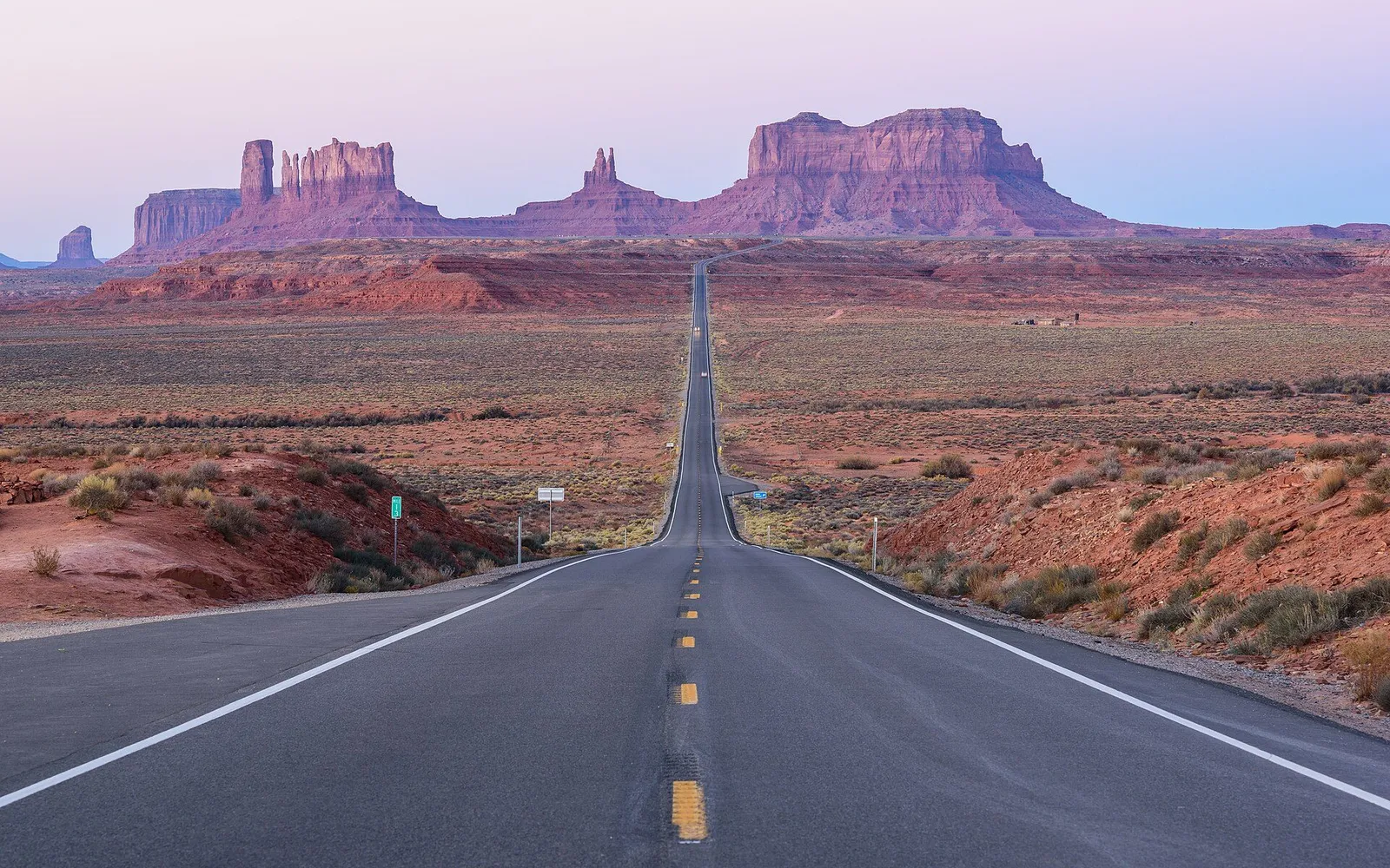
This loop is the best first road trip in the American Southwest because the geography does the planning for you: five headline destinations sit within a day’s drive of each other, none of the highways are difficult, and every night lands in a town with a bed and a diner. It rewards one piece of homework: buy the US$80 America the Beautiful pass at the first park gate, because Zion’s and Bryce’s fee tables waive the US$100 per-person surcharge for pass holders, a surcharge that currently applies to non-US residents aged 16 and over (our national parks guide explains the pass system). One purchase, then a week of hoodoos, slot canyons and rim-edge sunsets.
Day 1: Arrive in Las Vegas
Land, collect the rental car, and do the trip’s least glamorous errands: a supermarket run for a cooler of water and snacks (desert driving punishes the unprepared), downloaded offline maps, and a full tank. If you arrive early, walk the Strip once for the spectacle; the fountains are free. Skip the dam today, because it becomes a bonus stop on the way out tomorrow. Overnight near the Strip or, better, near the airport for a clean getaway.
Practical tip: Buy your park pass now, digitally, at recreation.gov (America the Beautiful, US$80): the digital pass prints at home and the first Zion gate will wave you through instead of making you do paperwork at 9 a.m., and it waives the non-resident surcharge at these parks per their fee pages.
Day 2: Las Vegas to Zion, First Look at the Canyon
About 160 miles and two and a half to three hours northeast, with an optional Hoover Dam photo stop 45 minutes in. Zion Village (Springdale) is where the park takes over: park at the visitor center, because private cars cannot drive Zion Canyon when the shuttle runs, and ride the free shuttle up past Court of the Patriarchs to Zion Lodge for a first afternoon walk, the Pa’rus Trail or the lower Emerald Pools. Entrance is US$35 per vehicle, valid seven days.
Practical tip: The shuttle runs from early morning to evening (in the fall window, roughly 7 a.m. to 6 p.m. out of the visitor center, last canyon exit about 7:15 p.m., per the park’s posted schedule); photograph the schedule at the shuttle stop, because missing the last bus means a very long walk.
Day 3: Zion Proper: Angels Landing or the Narrows
Full day inside the canyon, starting with the first shuttle. Angels Landing’s chained spine requires a permit for every hiker (lotteries run on recreation.gov, both a seasonal draw and a day-before draw, small fees apply), and Scout Lookout, the viewpoint one mile before it, requires nothing and gives away most of the view. In the afternoon, walk the Riverside Walk and wade into the Narrows if water levels are normal. Slot canyons flash-flood: check today’s forecast at the visitor center before touching the river.
Practical tip: Apply for the Angels Landing day-before lottery the day before, on recreation.gov, as a backup to the seasonal draw; and whatever you hike, start by 8 a.m., because the canyon’s shade disappears by late morning and the shuttle queues double after 10.
Day 4: Over the Mountain to Bryce Canyon
About 85 miles and under two hours by the scenic route: the Zion-Mount Carmel Highway’s switchbacks and its mile-long tunnel (vehicles over 11 feet 4 inches tall need a tunnel permit and escort; ordinary cars and rentals pass free), then US-89 north past Red Canyon’s twin arches. Arrive by early afternoon for the rim: Sunrise, Sunset and Inspiration Points, linked by an easy rim trail at 8,000 to 9,000 feet. Bryce’s entrance is US$35 per vehicle, valid seven days. Overnight Bryce Canyon City, outside the gate.
Practical tip: Bryce sits high: nights drop near freezing even in summer, and the thin air makes hills harder, so pack the fleece, drink more water than feels reasonable and take the rim walk slowly on arrival day.
Day 5: Bryce Sunrise, then the Drive to Page
Sunrise at Sunrise Point is the trip’s best free show; the hoodoo amphitheater goes from gray to fire-orange in twenty minutes. Walk the Navajo Loop and Queen’s Garden combination (about three miles, the park’s finest hour and a half), then drive south to Page, about 150 miles and two and a half hours across the Grand Staircase country. In the late afternoon, walk the 0.6-mile sand trail out to Horseshoe Bend’s overlook (parking US$10 per vehicle, open sunrise to sunset, self-guided, and note the city lot does not accept the national parks pass).
Practical tip: Horseshoe Bend’s rim has limited guardrails and real drops; keep kids and phones leashed, and time your visit for the last two hours of daylight, when the light turns the river emerald and the tour buses are gone.
Day 6: Antelope Canyon, then the Grand Canyon’s East Rim
Antelope Canyon, the world’s most photographed slot canyon, sits on Navajo land and can only be entered on a guided tour with an authorized Navajo operator (typical tours run one to two hours; book well ahead at navajonationparks.org or an authorized Page outfitter, expect roughly US$80-150 depending on section and season). By early afternoon, take AZ-64 west from Page toward the Grand Canyon’s east entrance: about 140 miles and two and a half hours, arriving for sunset at the Desert View Watchtower. Overnight in Tusayan or the park village.
Practical tip: Antelope tours sell out weeks ahead in summer and the canyon floor stays cool and dark, so book the late-morning slot for the best light beams and bring the wide-angle shot you practiced; the park entrance here is US$35 per vehicle, seven days, no reservation needed.
Day 7: Grand Canyon South Rim, All Day
The South Rim is open all year and rewards repetition: morning light from Mather Point, the Rim Trail’s flat miles west toward the village, the Yavapai Geology Museum’s window of rock, and Hermit Road by free shuttle for the cliff-edge viewpoints. Do not plan to hike below the rim and back out in one go; the signs are serious, and the canyon is 40 degrees hotter at the river than on the rim. Sunset from Hopi Point if you have the energy. Second night in Tusayan or the village.
Practical tip: The Rim Trail between the village and Hermits Rest is shuttle-serviced, so walk one direction and ride back; carry a liter of water per person per hour of summer hiking, because the dry heat hides how much you are losing.
Day 8: The Long Way Home to Las Vegas
About 280 miles and four and a half hours back to Las Vegas, and the drive is part of the trip: AZ-64 and US-93 retrace the Colorado’s canyons, with a worthwhile stop at Seligman, the best-preserved strip of Route 66, for lunch, or the Hoover Dam bridge walkway if you skipped it on day 2. Drop the car at Las Vegas airport by mid-afternoon for evening flights, or bank one last Strip night if you fly tomorrow.
Practical tip: Refuel before leaving the park roads (gas inside and around the parks runs expensive) and return the car with a full tank at a fuel station on the airport approach; the rental lots charge a premium per gallon for the same favor (our driving guide covers US fuel and toll basics).
Practical Notes
Intercity transport (all by rental car; there is no useful transit between these parks)
| Leg | Distance | Drive time | Notes |
|---|---|---|---|
| Las Vegas to Springdale (Zion) | 160 mi | 2.5-3h | Optional Hoover Dam stop |
| Springdale to Bryce Canyon City | 85 mi | ~1.5-2h | Zion-Mount Carmel tunnel en route |
| Bryce Canyon City to Page | 150 mi | ~2.5h | Grand Staircase scenery |
| Page to Grand Canyon South Rim | 140 mi | ~2.5h | East entrance, Desert View first |
| South Rim to Las Vegas | 280 mi | ~4.5h | Seligman and Route 66 en route |
Distances and times are map-based approximations; the whole loop is about 720 miles of paved highway, no four-wheel drive needed.
Fees and reservations, the honest list (as of October 2026)
- Zion: US$35 per vehicle, valid 7 days; no park reservation needed; free shuttle required in the canyon when running; Angels Landing needs a per-hiker permit via recreation.gov lottery
- Bryce: US$35 per vehicle, valid 7 days
- Grand Canyon South Rim: US$35 per vehicle, valid 7 days; no timed entry (the park’s own page says so); free shuttles on Hermit Road and in the village
- At Zion and Bryce, non-US residents aged 16+ currently pay a US$100 per-person surcharge unless the vehicle holds an America the Beautiful or annual pass, per the parks’ fee pages; the US$80 pass (digital at recreation.gov or at any gate) pays for itself immediately on this trip
- Horseshoe Bend: US$10 per vehicle parking (City of Page lot), no parks pass accepted
- Antelope Canyon: guided tours only, authorized Navajo operators, roughly US$80-150, book weeks ahead
Budget estimate (per person, 8 days, excluding flights to and from Las Vegas, assuming two people share car and fuel)
- Backpacker: US$1,100-1,600. Motels in Springdale’s cheaper corners and Bryce Canyon City, supermarket food, one Antelope tour
- Mid-range: US$2,000-3,000. Springdale and Tusayan three-stars, the Antelope tour, a helicopter or float trip splurge, one sit-down dinner a day
- Comfort: US$3,500-6,000. Historic lodge nights inside the parks (book 6-13 months out), private guides, upper-tier Antelope photography tours
Sales tax gets added at the register, restaurant checks expect 18 to 22 percent tips (see our tipping and sales tax guide), and park lodge pricing is seasonal (run quotes through our Real Price Calculator).
Car vs train vs plane verdict
This is a driving itinerary; nothing on the route is reachable by train or useful bus, and the airports (Las Vegas, Page’s tiny field) do not connect the parks. Rent at Las Vegas airport, drive the loop, drop at Las Vegas airport; a standard sedan handles every mile. The one caution belongs in bold: this is desert country where a breakdown or a rim fall becomes an American hospital bill without insurance, and rescue helicopters fly here every week, so carry real travel medical cover before you go (our health and safety guide tells you what to check).
Sources & verification (11)
- https://www.nps.gov/zion/planyourvisit/fees.htm
- https://www.nps.gov/zion/planyourvisit/zion-canyon-shuttle-system.htm
- https://www.nps.gov/zion/planyourvisit/permitsandreservations.htm
- https://www.nps.gov/zion/planyourvisit/zion-mount-carmel-highway.htm
- https://www.nps.gov/brca/planyourvisit/fees.htm
- https://www.nps.gov/grca/planyourvisit/fees.htm
- https://www.nps.gov/grca/planyourvisit/index.htm
- https://store.usgs.gov/pass
- https://www.navajonationparks.org/
- https://horseshoebend.com/
- https://www.recreation.gov/